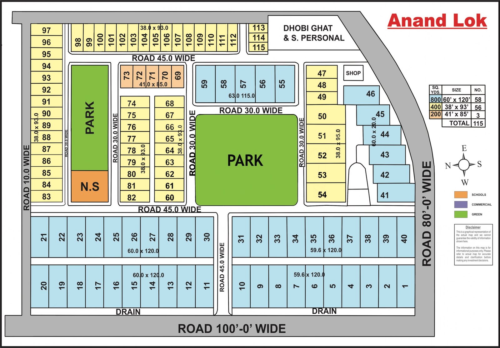
South Delhi locality maps
Layout plans for 39 colonies, showing blocks, parks, main roads and plot numbering. Open a map to view it full size and click to zoom.
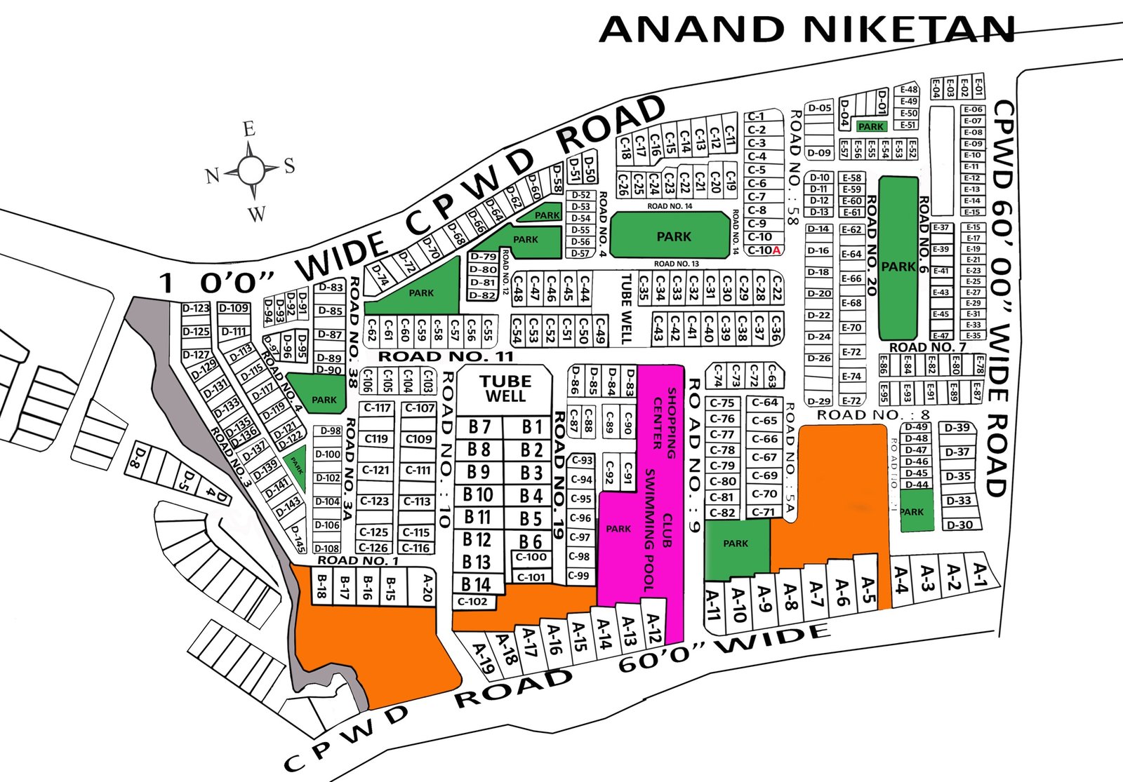
Anand Niketan
Full size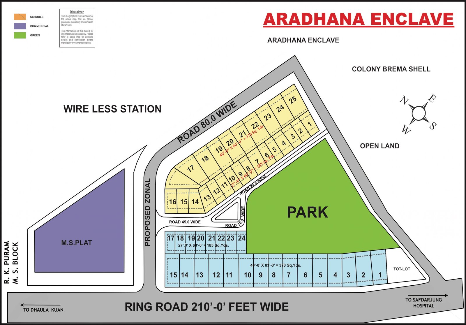
Aradhana Enclave
Full size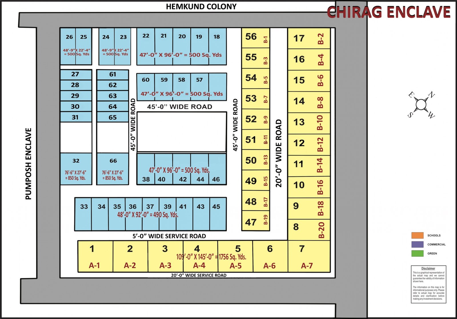
Chirag Enclave
Full size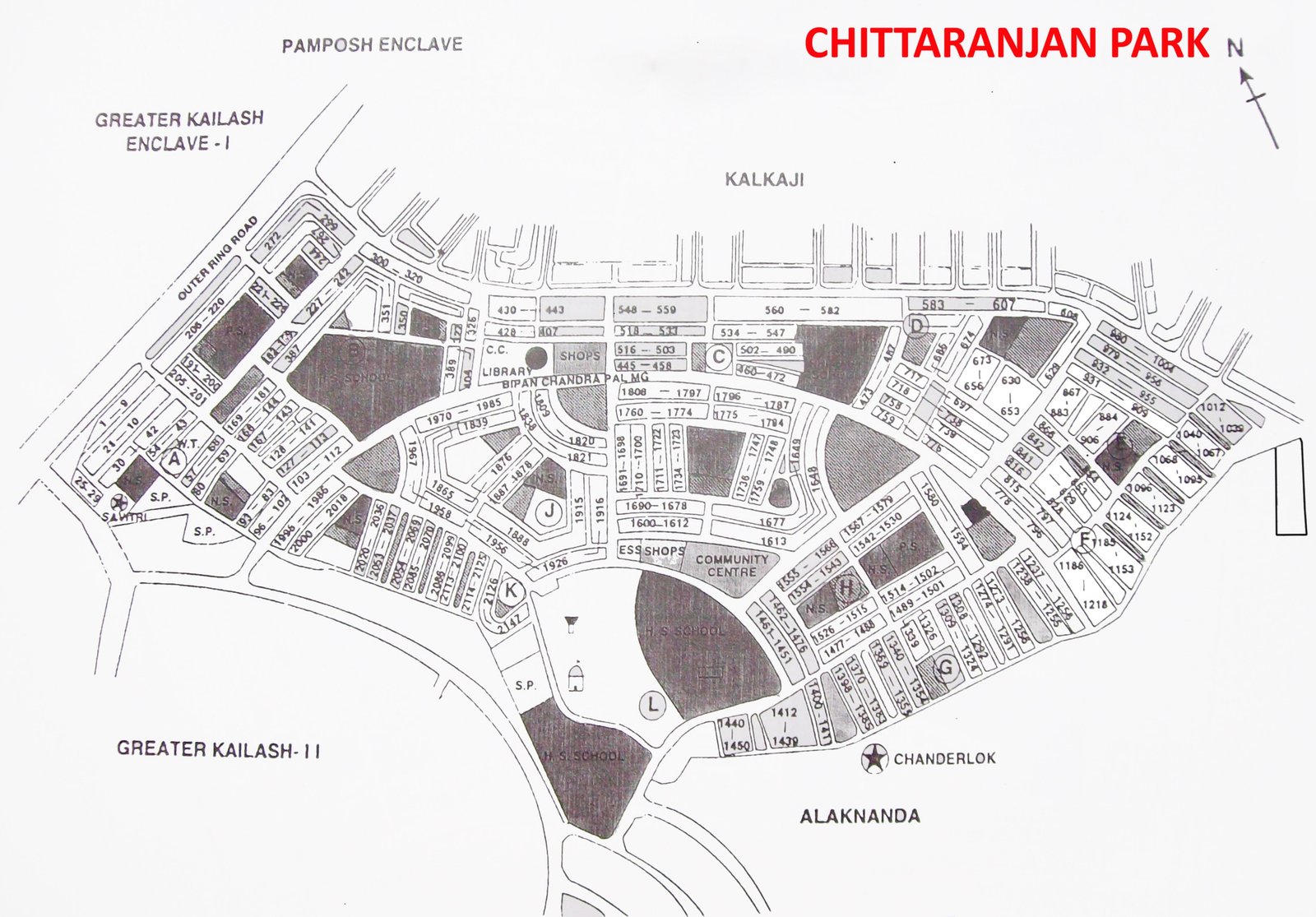
Chittaranjan Park (C.R. Park)
Full size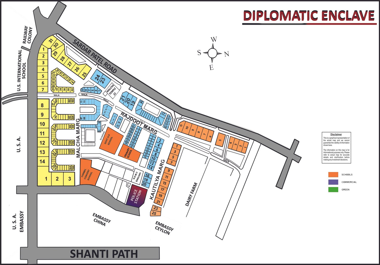
Diplomatic Enclave (Chanakyapuri)
Full size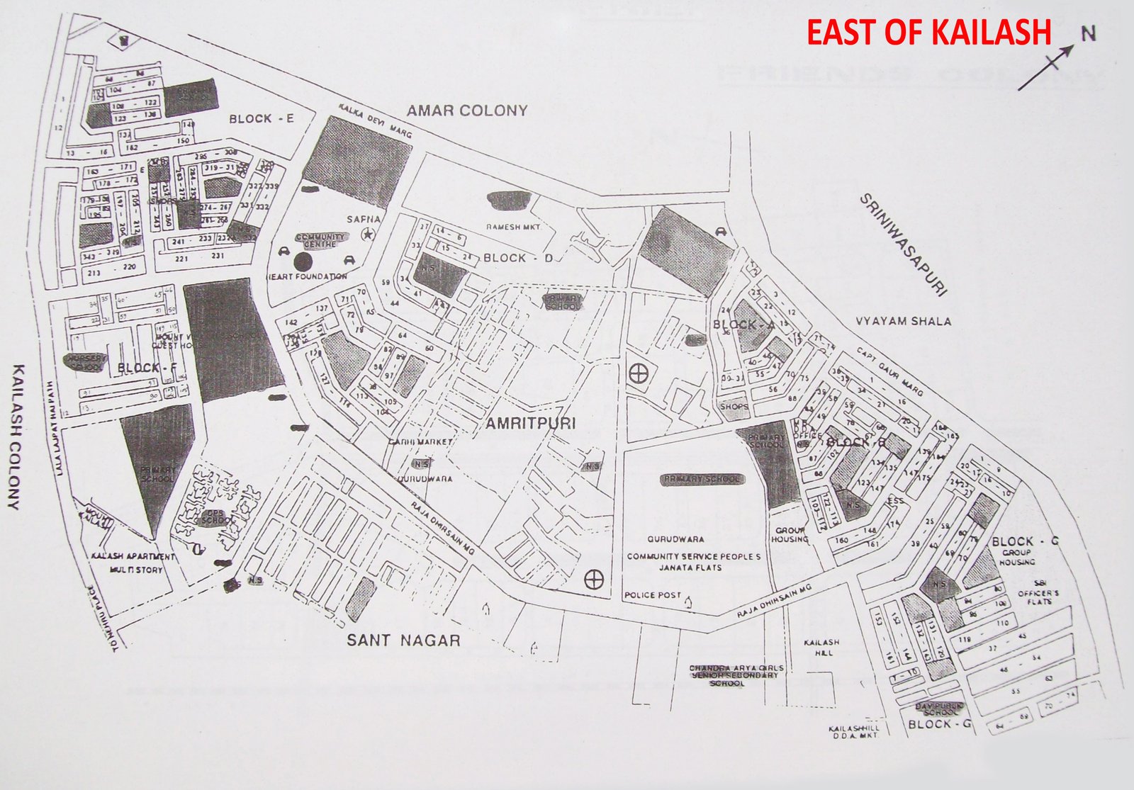
East of Kailash
Full size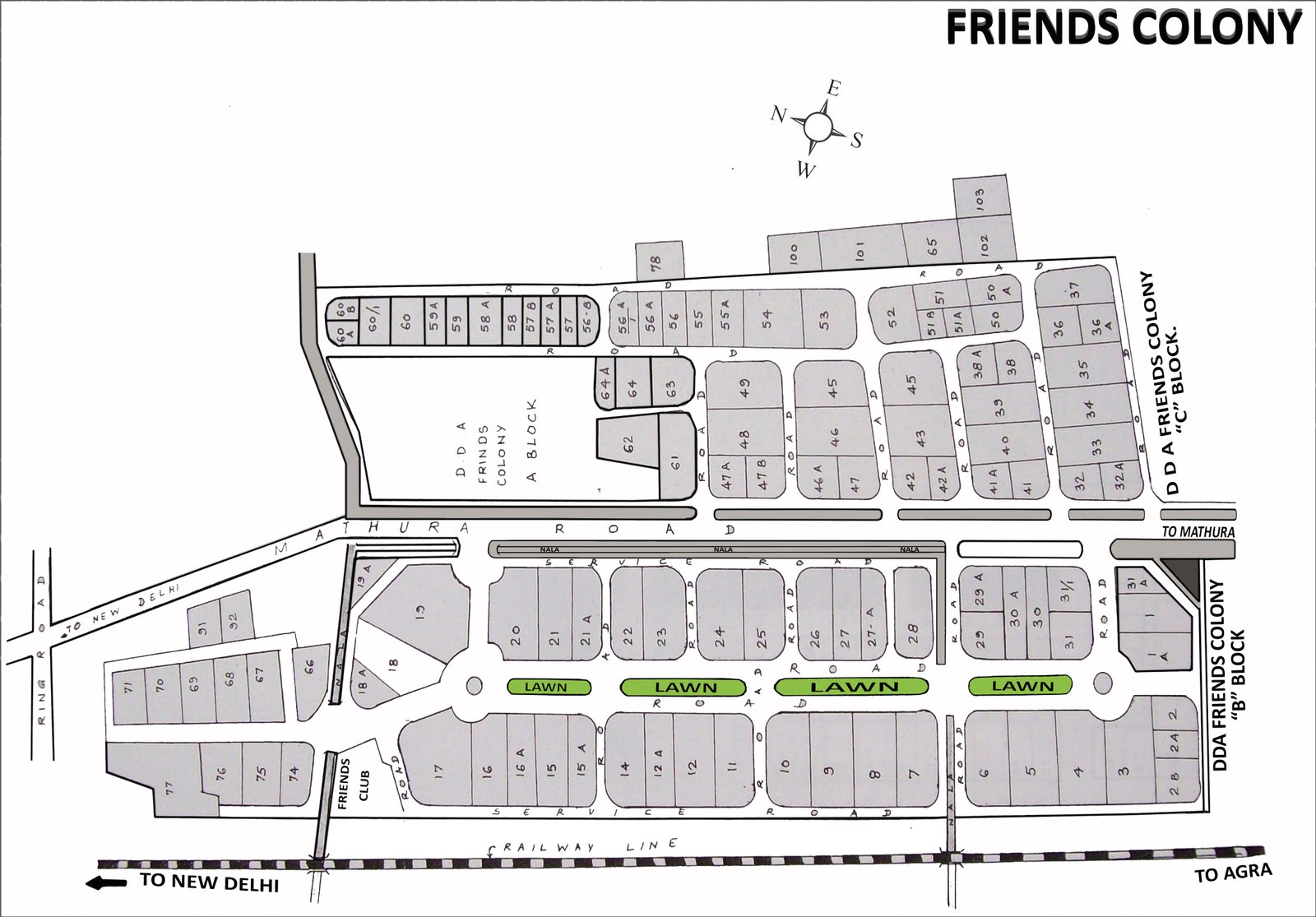
Friends Colony
Full size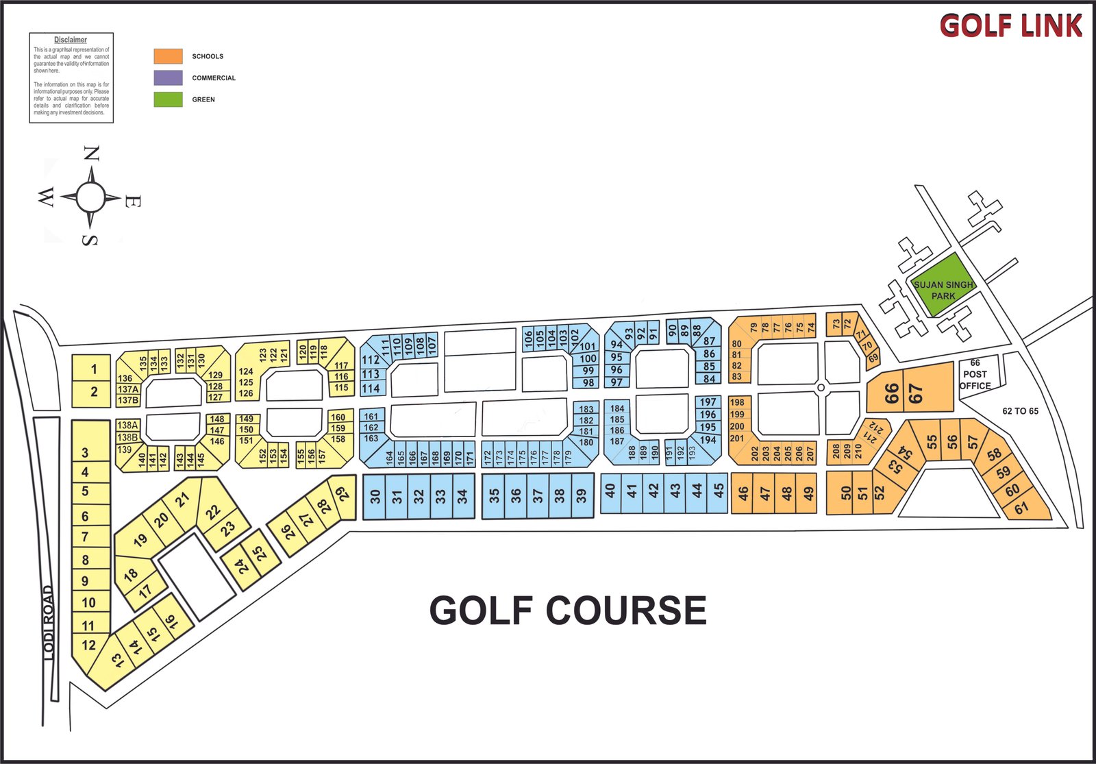
Golf Links
Full size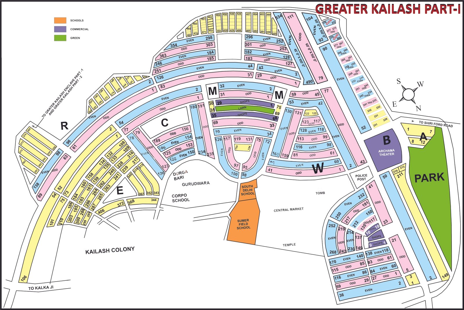
Greater Kailash Part-I
Full size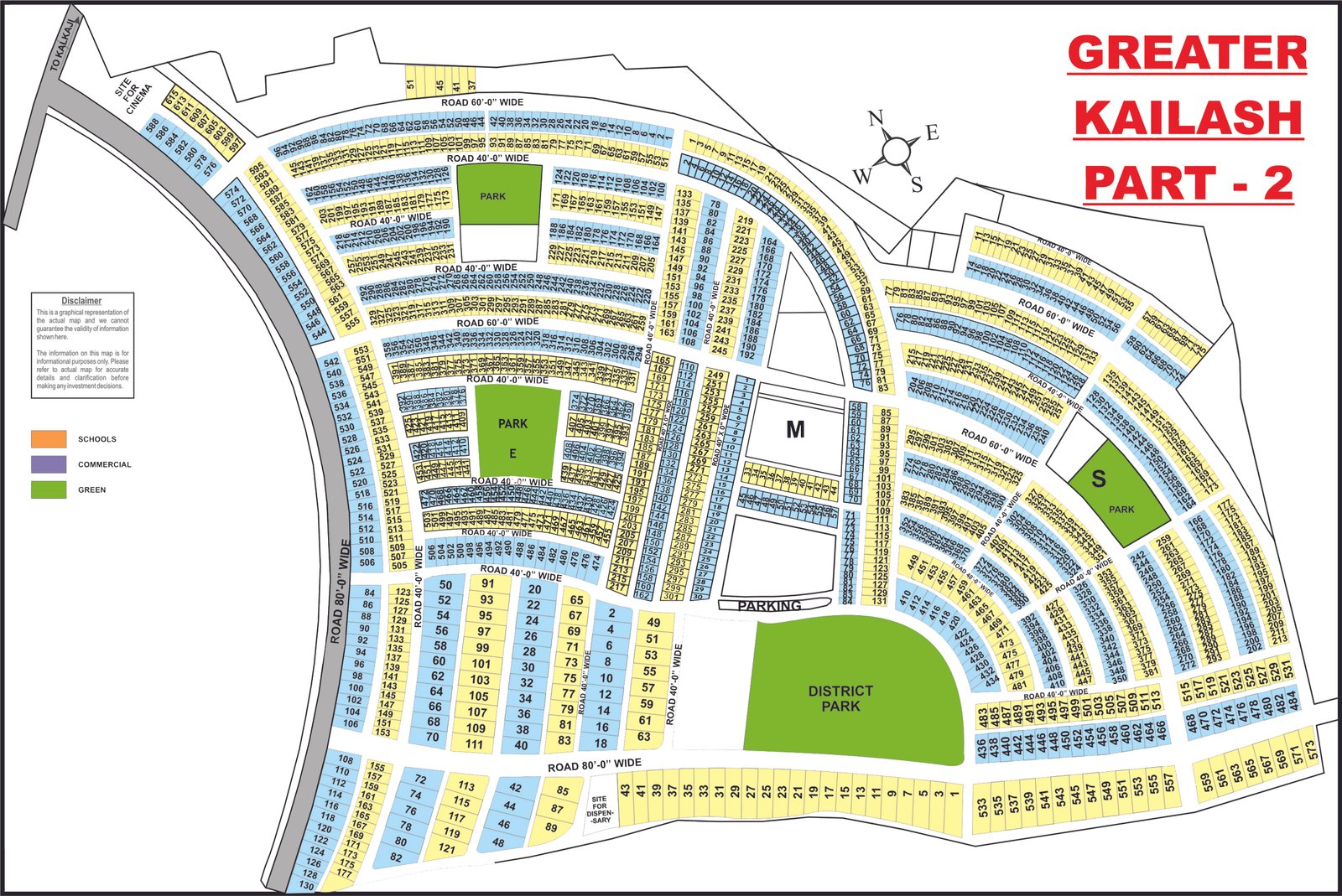
Greater Kailash Part-II
Full size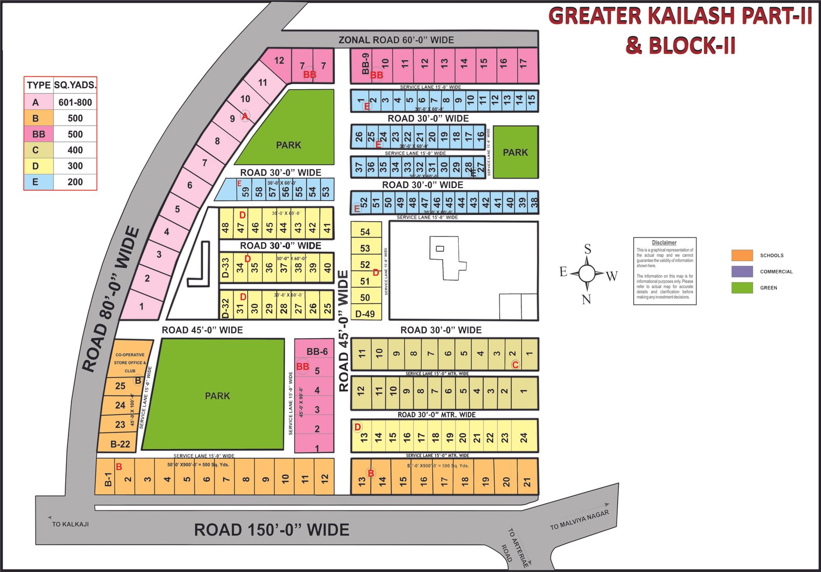
Greater Kailash Part-II & Block-II
Full size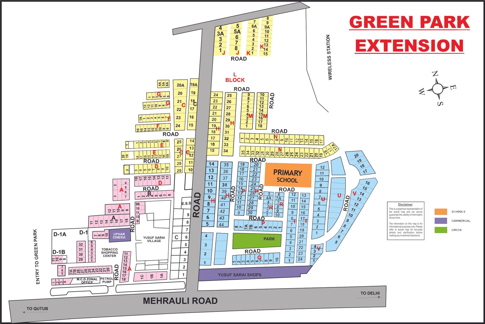
Green Park Extension
Full size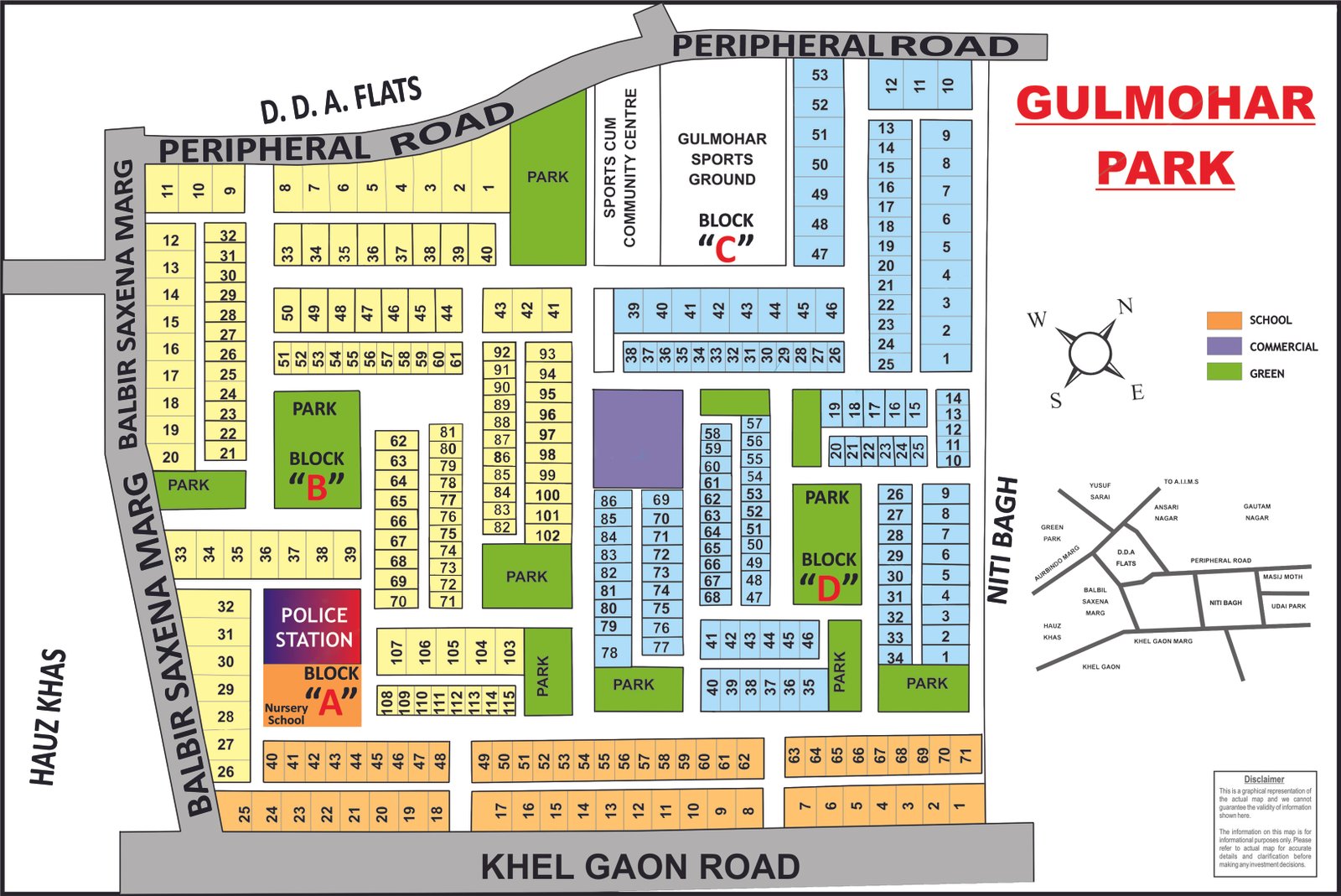
Gulmohar Park
Full size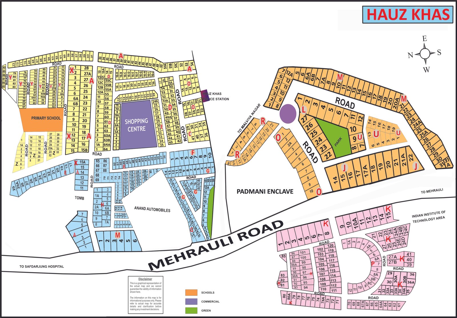
Hauz Khas
Full size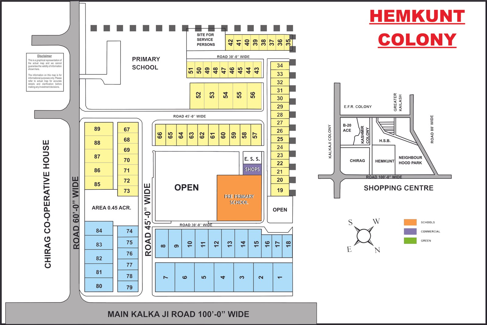
Hemkunt Colony
Full size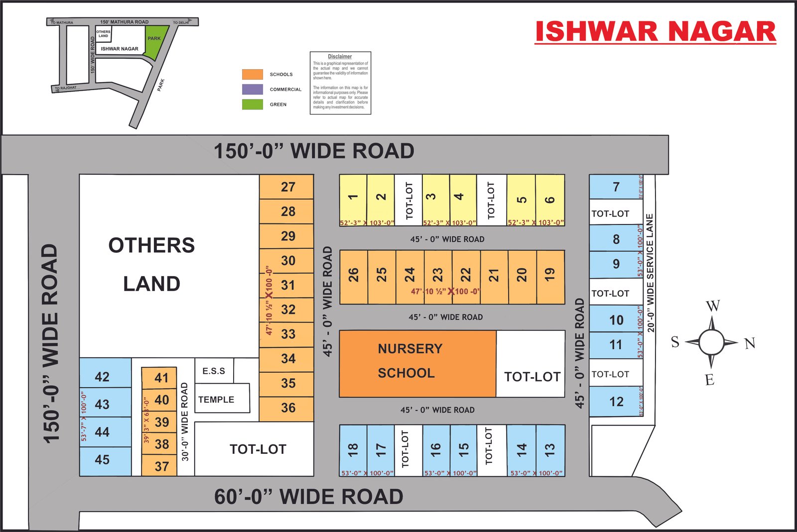
Ishwar Nagar
Full size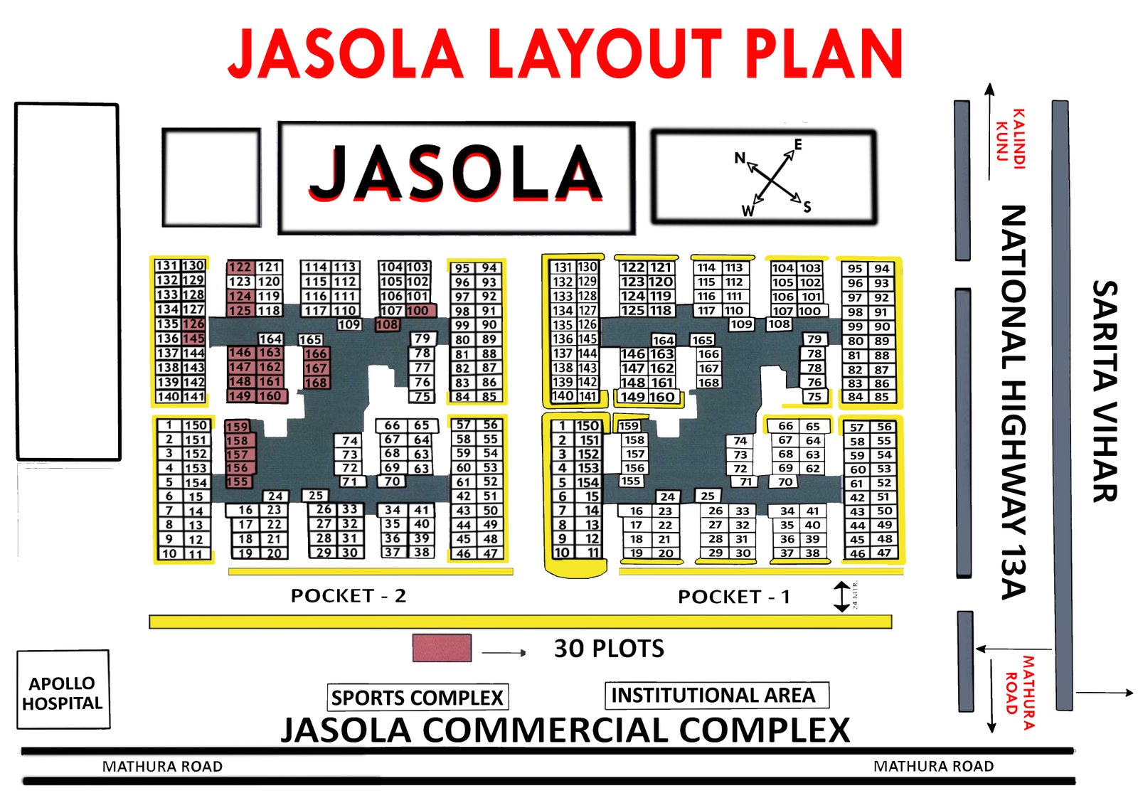
Jasola
Full size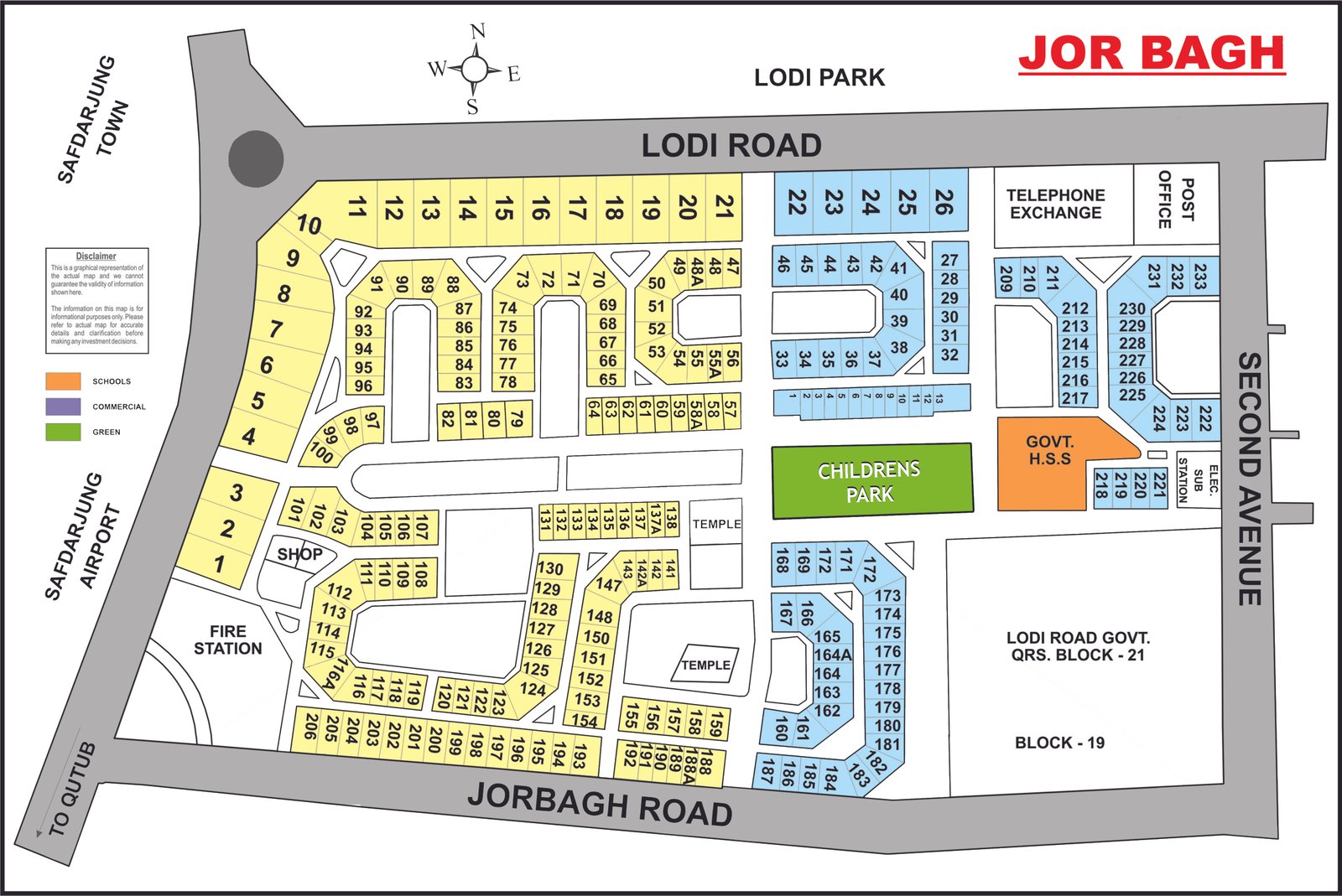
Jor Bagh
Full size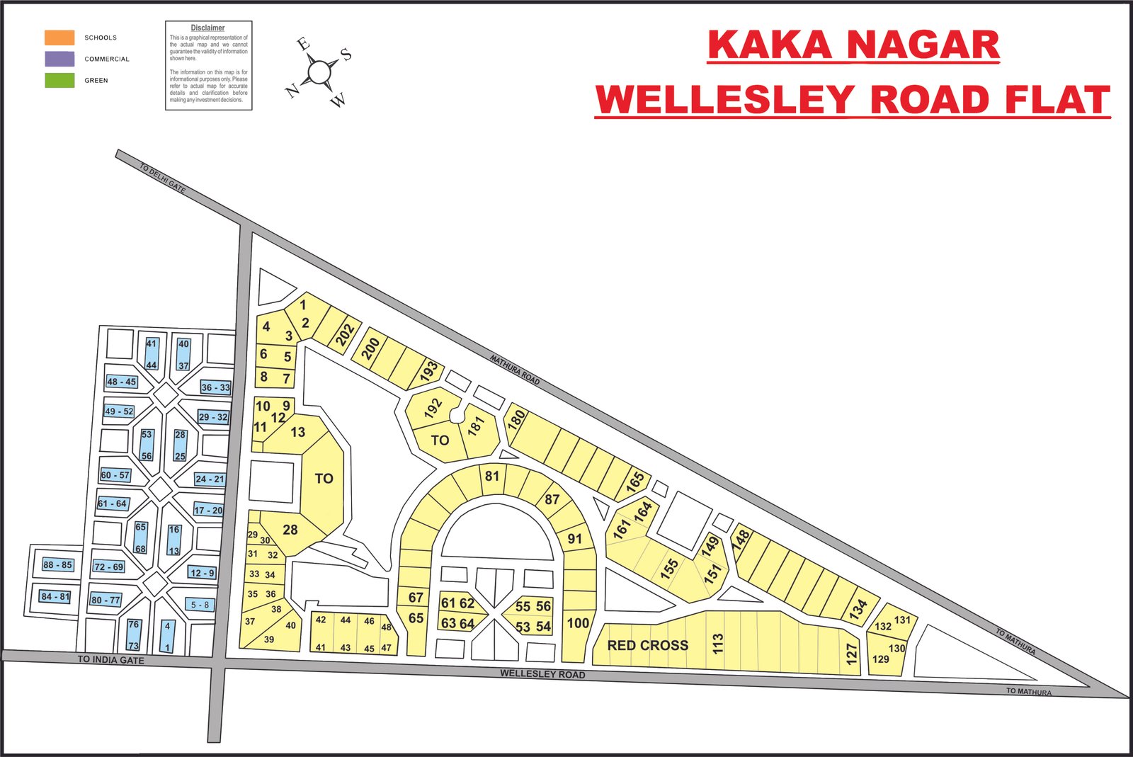
Kaka Nagar & Wellesley Road Flats
Full size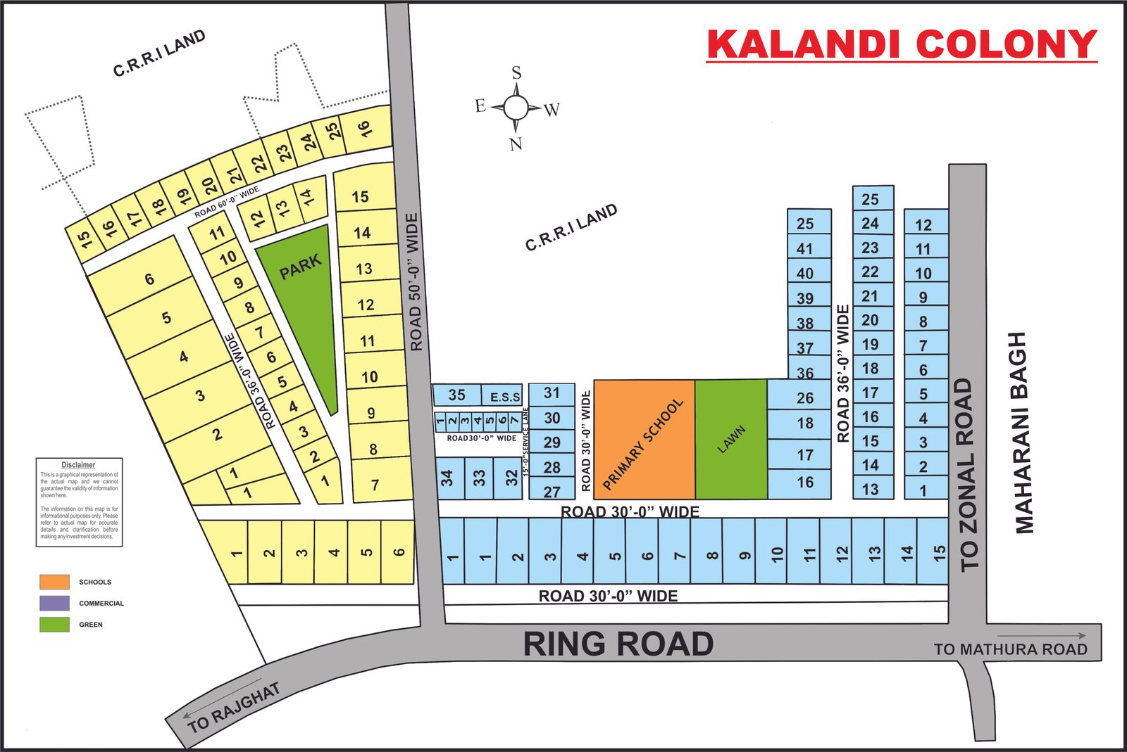
Kalindi Colony
Full size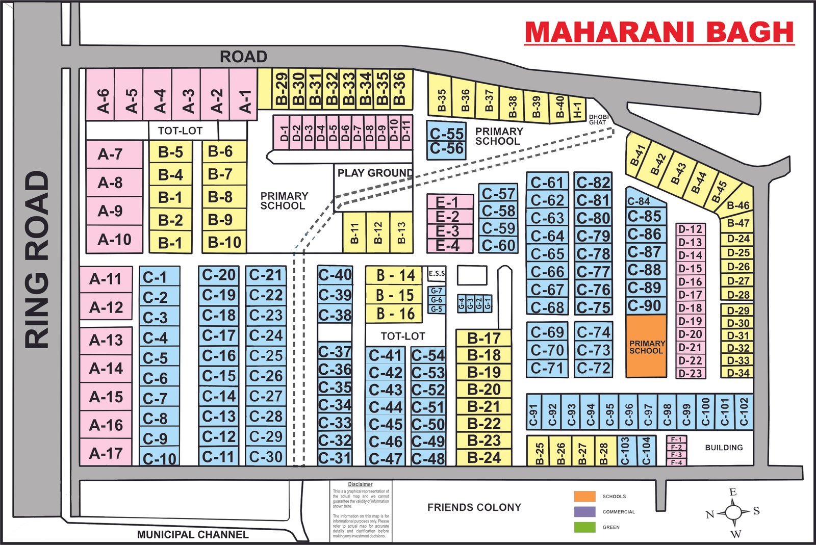
Maharani Bagh
Full size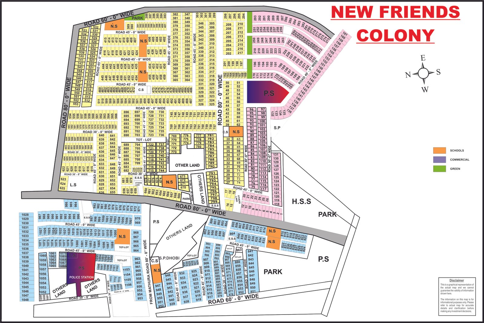
New Friends Colony
Full size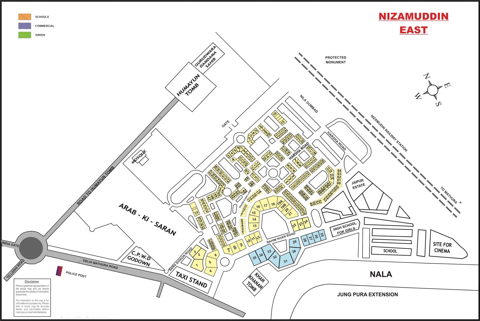
Nizamuddin East
Full size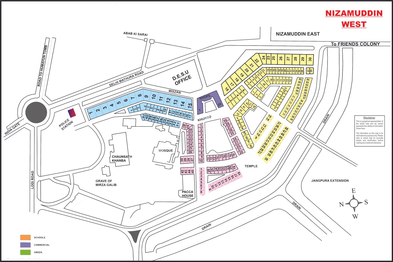
Nizamuddin West
Full size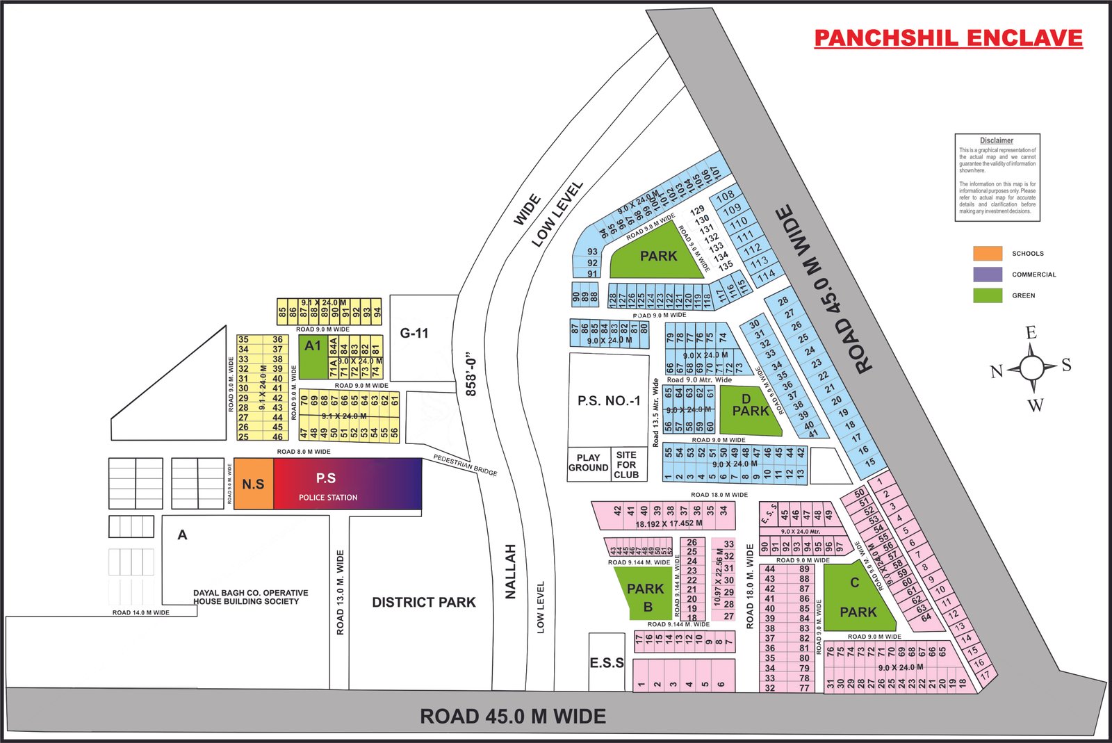
Panchsheel Enclave
Full size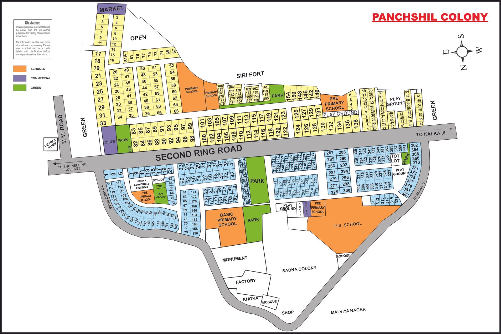
Panchsheel Park
Full size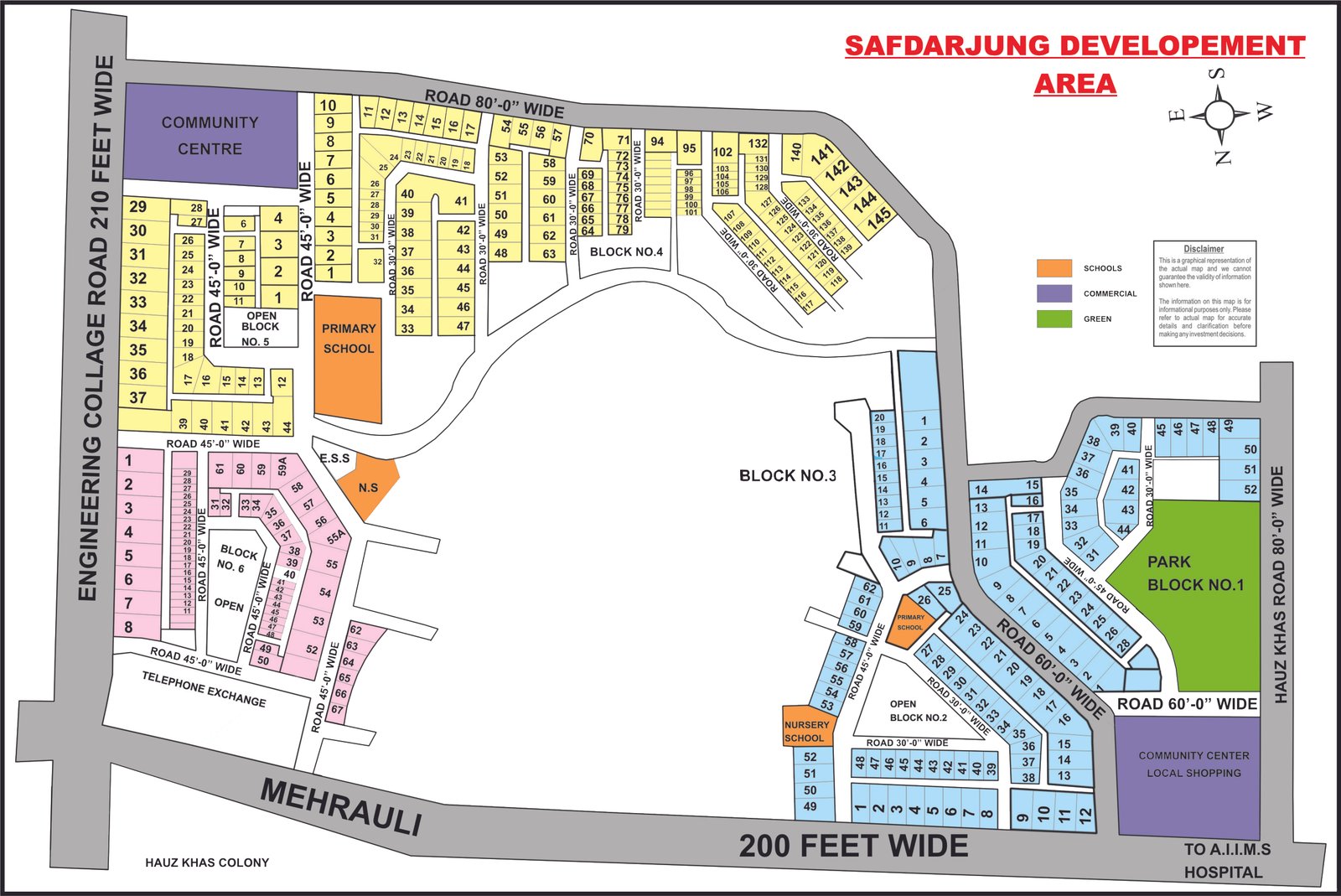
Safdarjung Development Area
Full size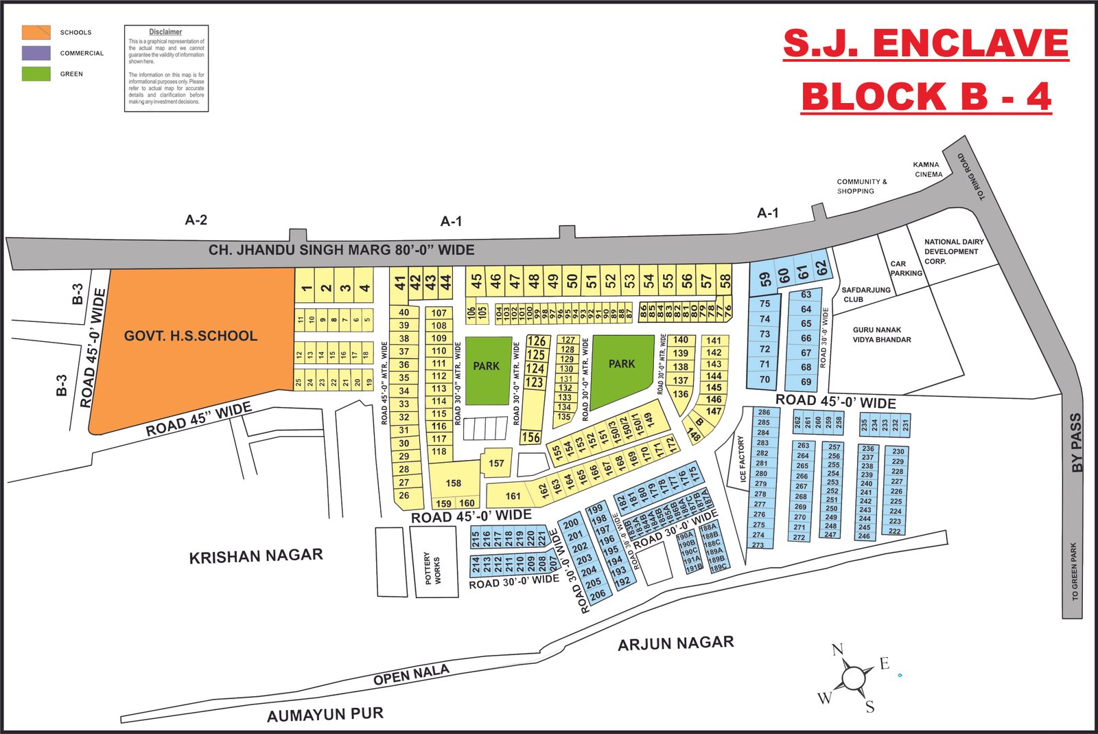
Safdarjung Enclave – Block B-4
Full size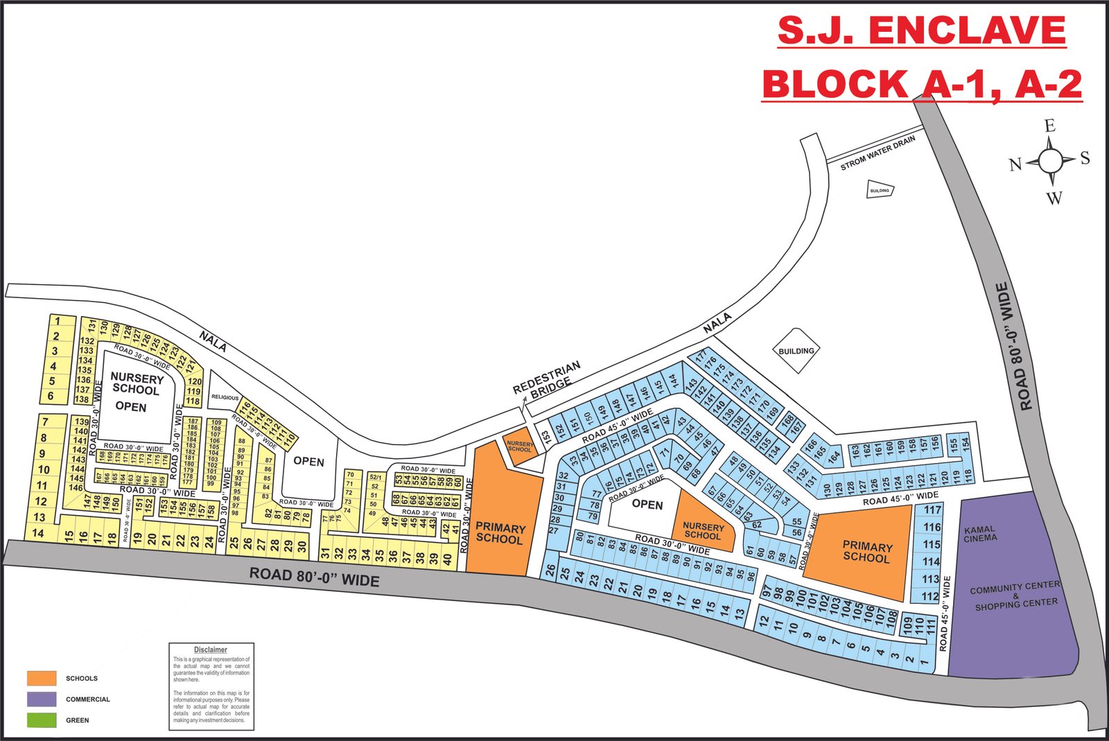
Safdarjung Enclave – Blocks A-1 & A-2
Full size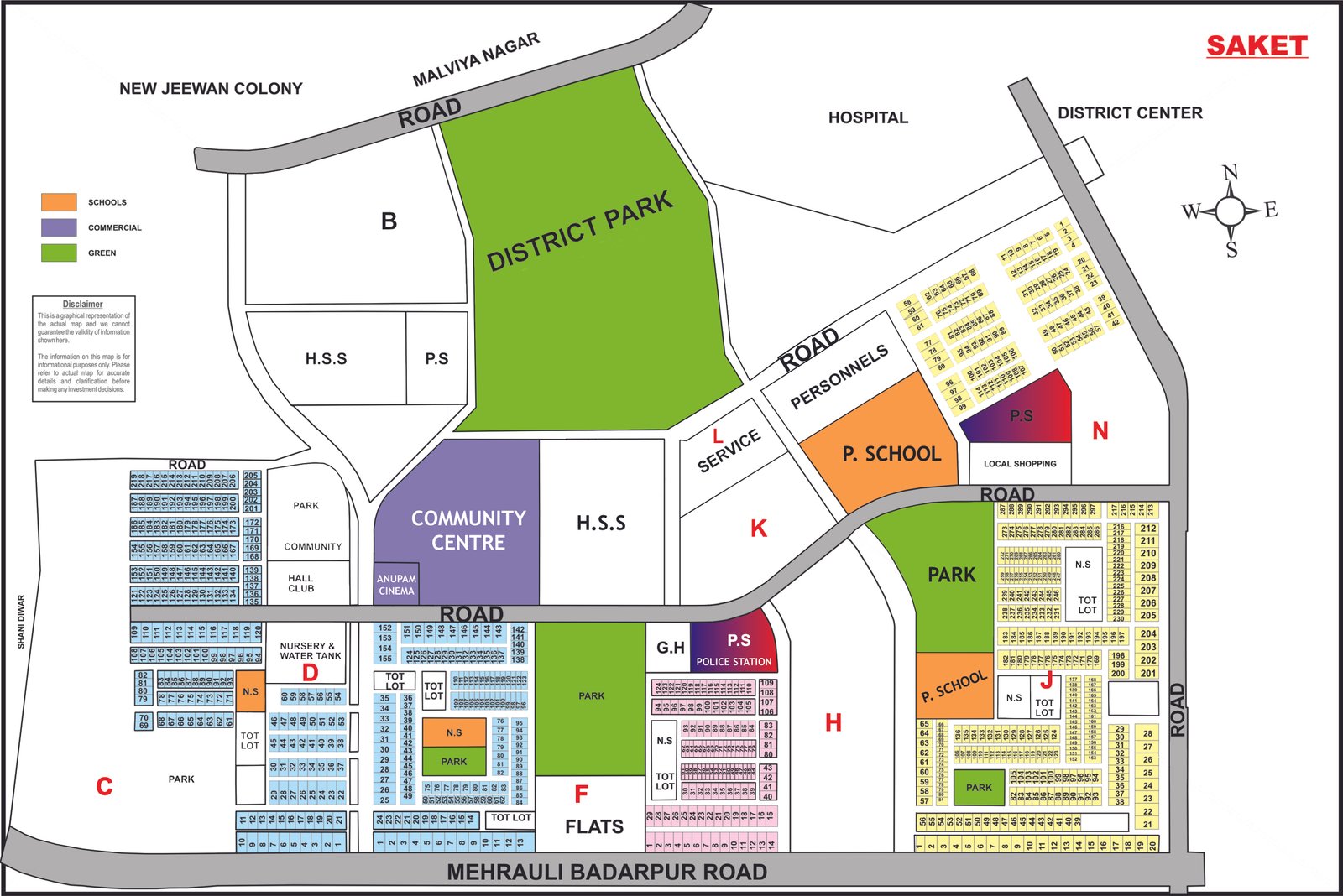
Saket
Full size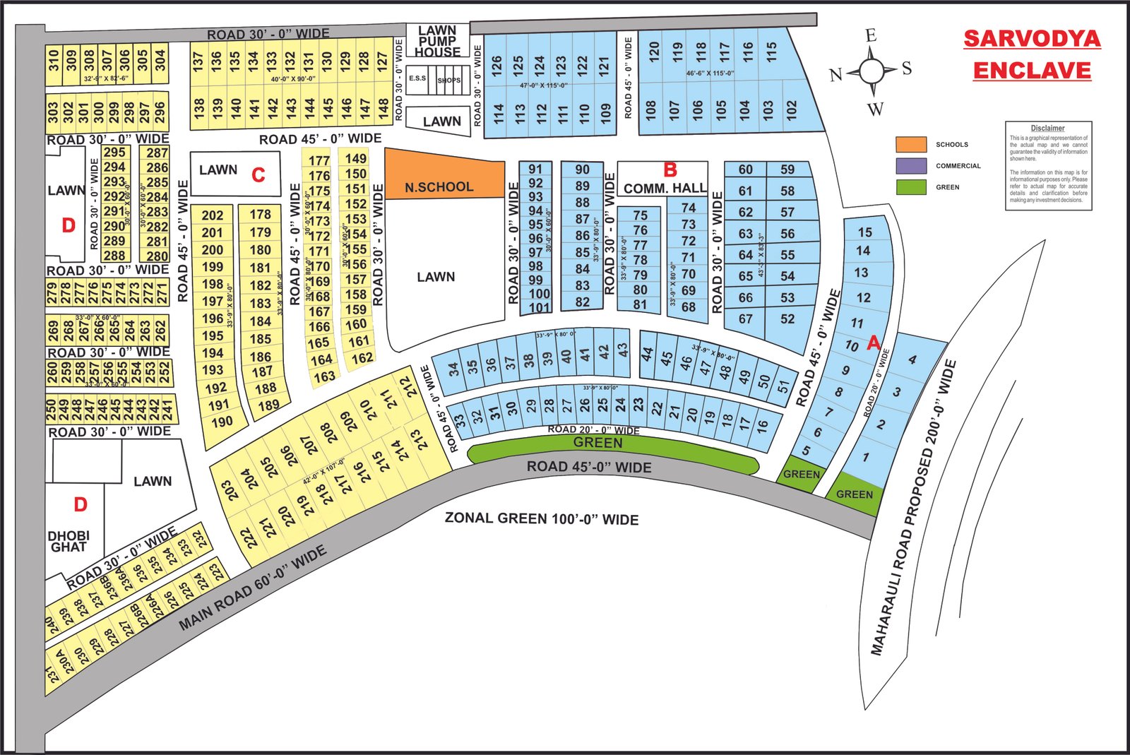
Sarvodaya Enclave
Full size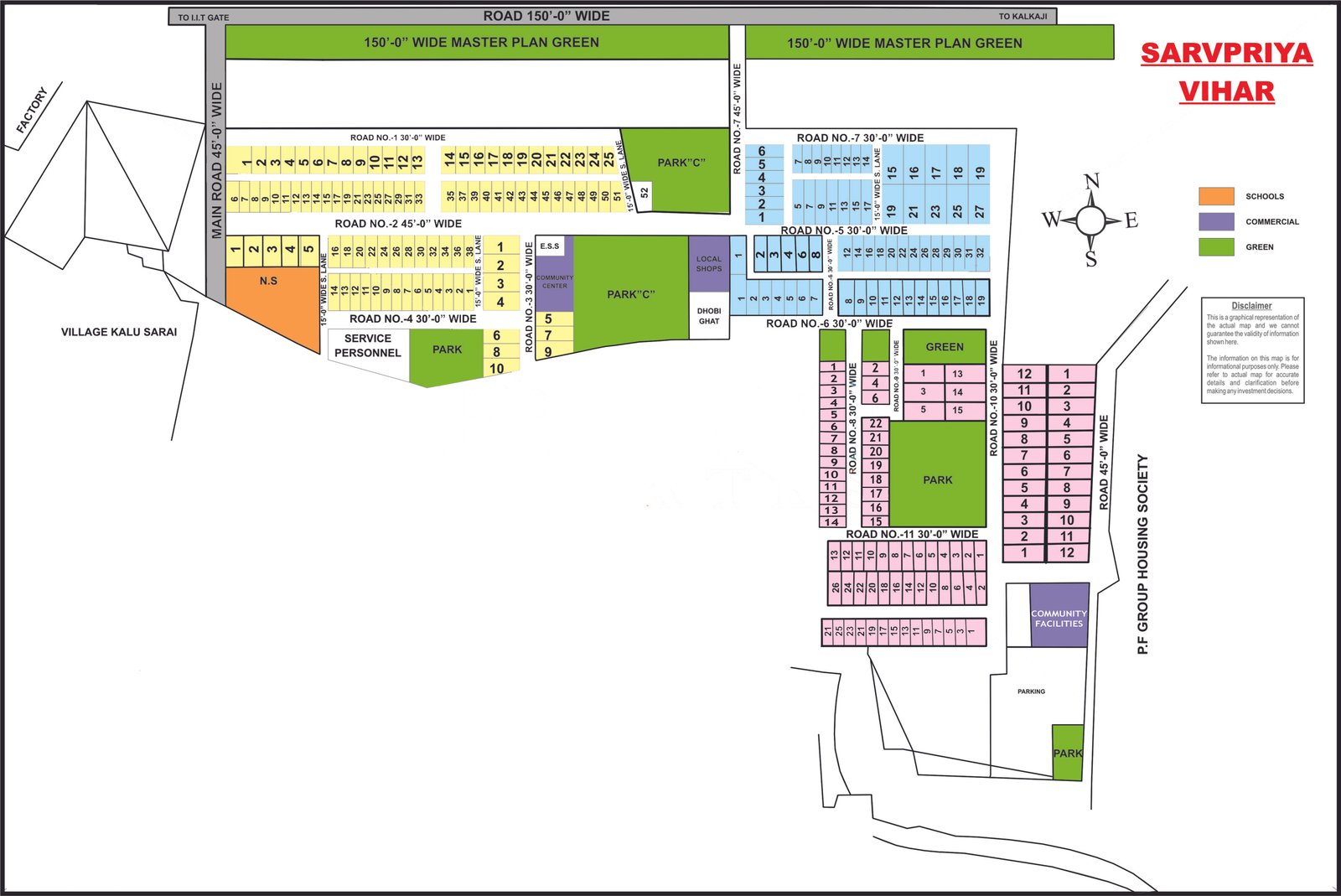
Sarvpriya Vihar
Full size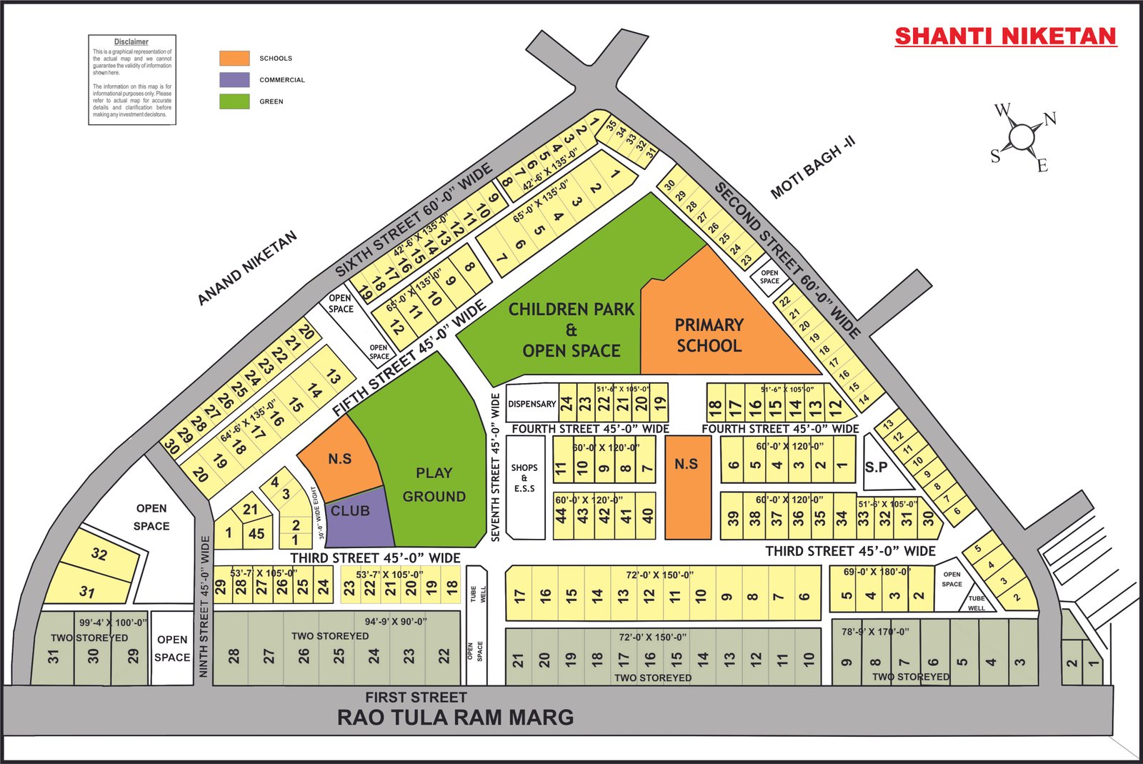
Shanti Niketan
Full size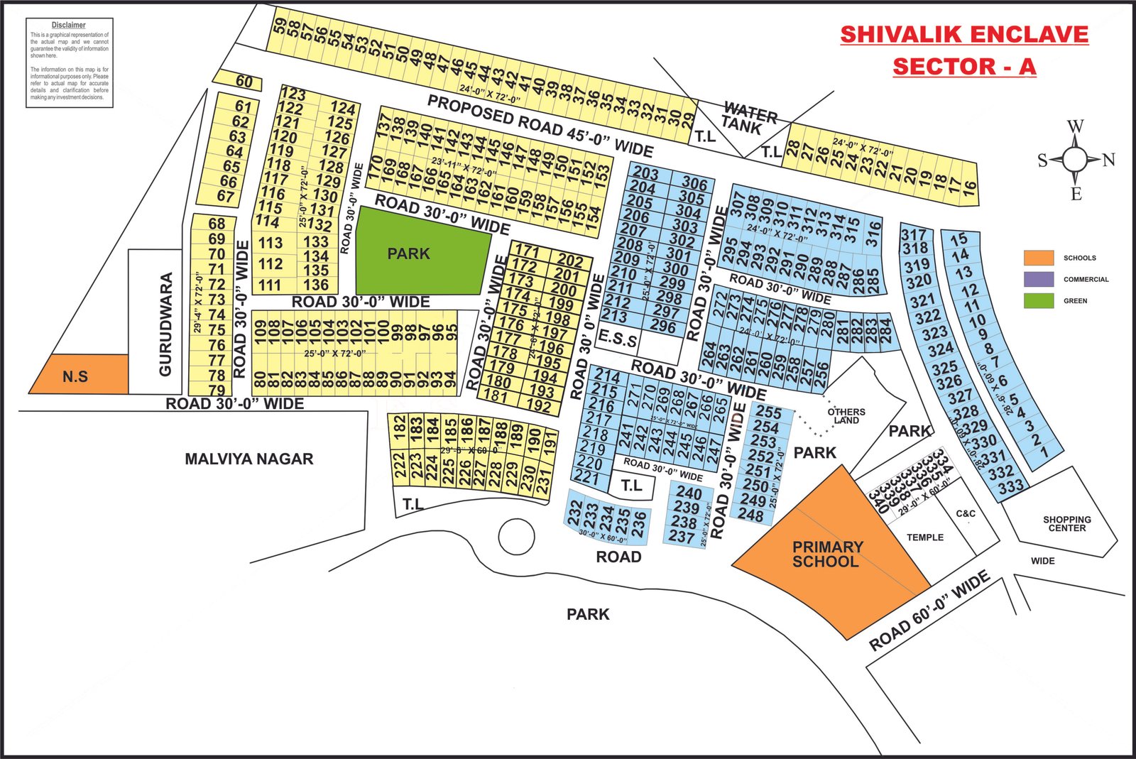
Shivalik Enclave – Sector A
Full size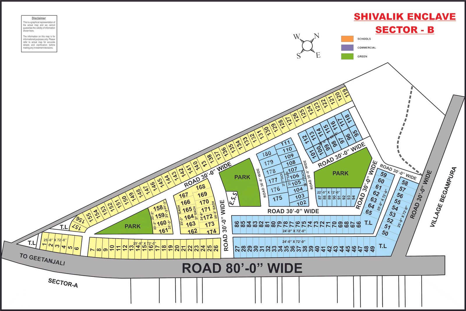
Shivalik Enclave – Sector B
Full size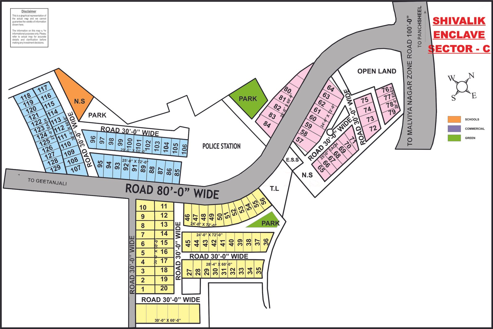
Shivalik Enclave – Sector C
Full size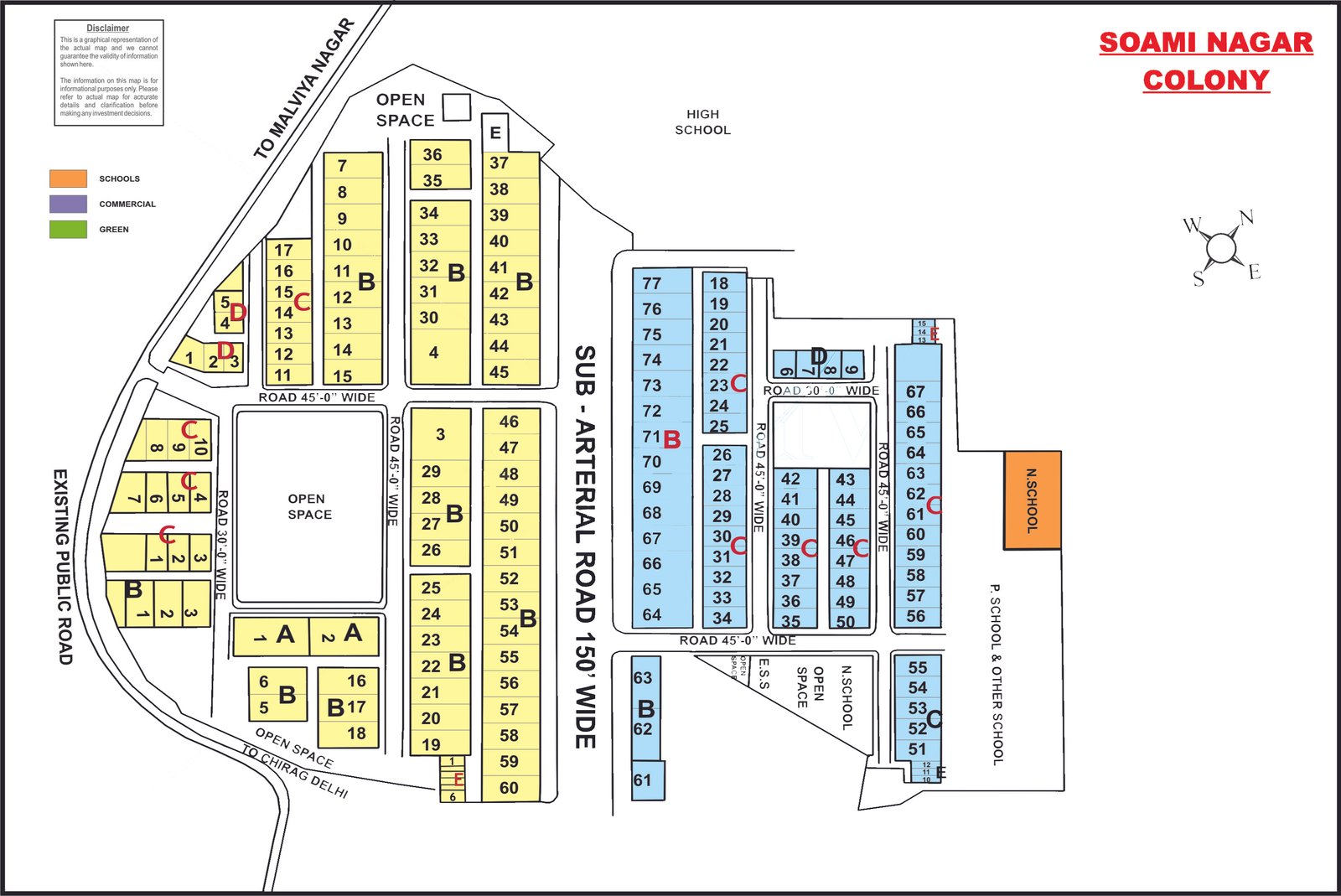
Soami Nagar
Full size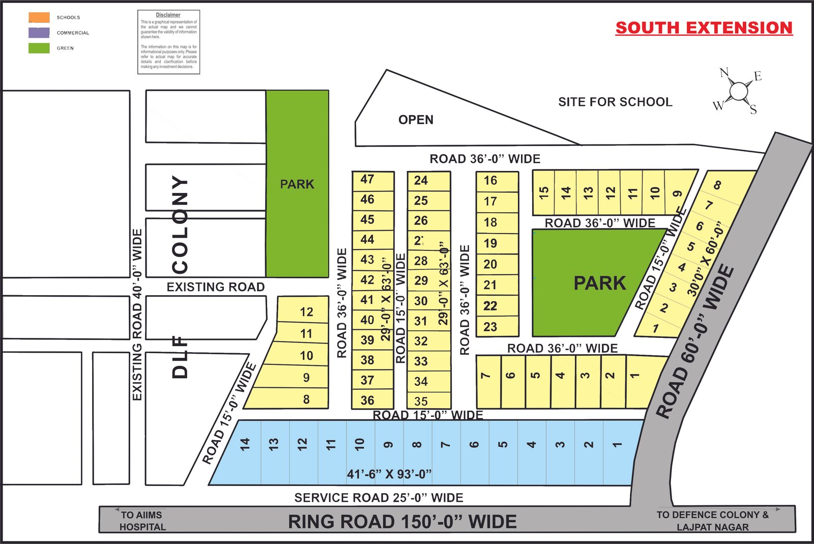
South Extension (Ring Road side)
Full size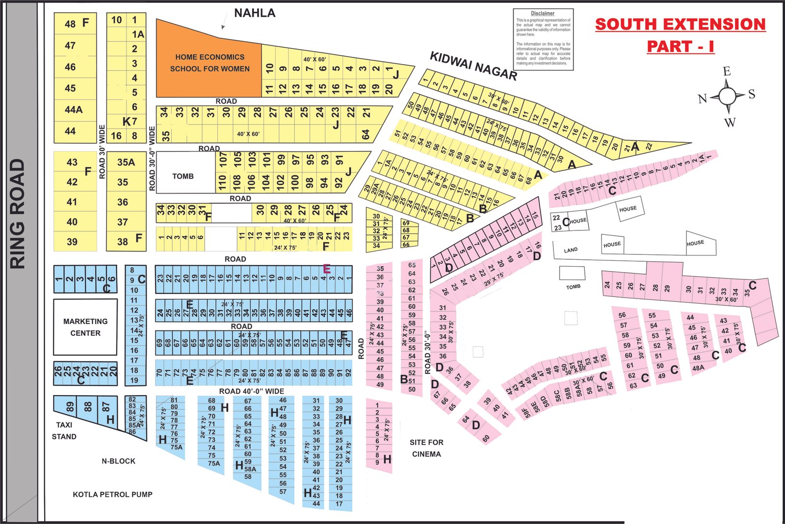
South Extension Part-I
Full size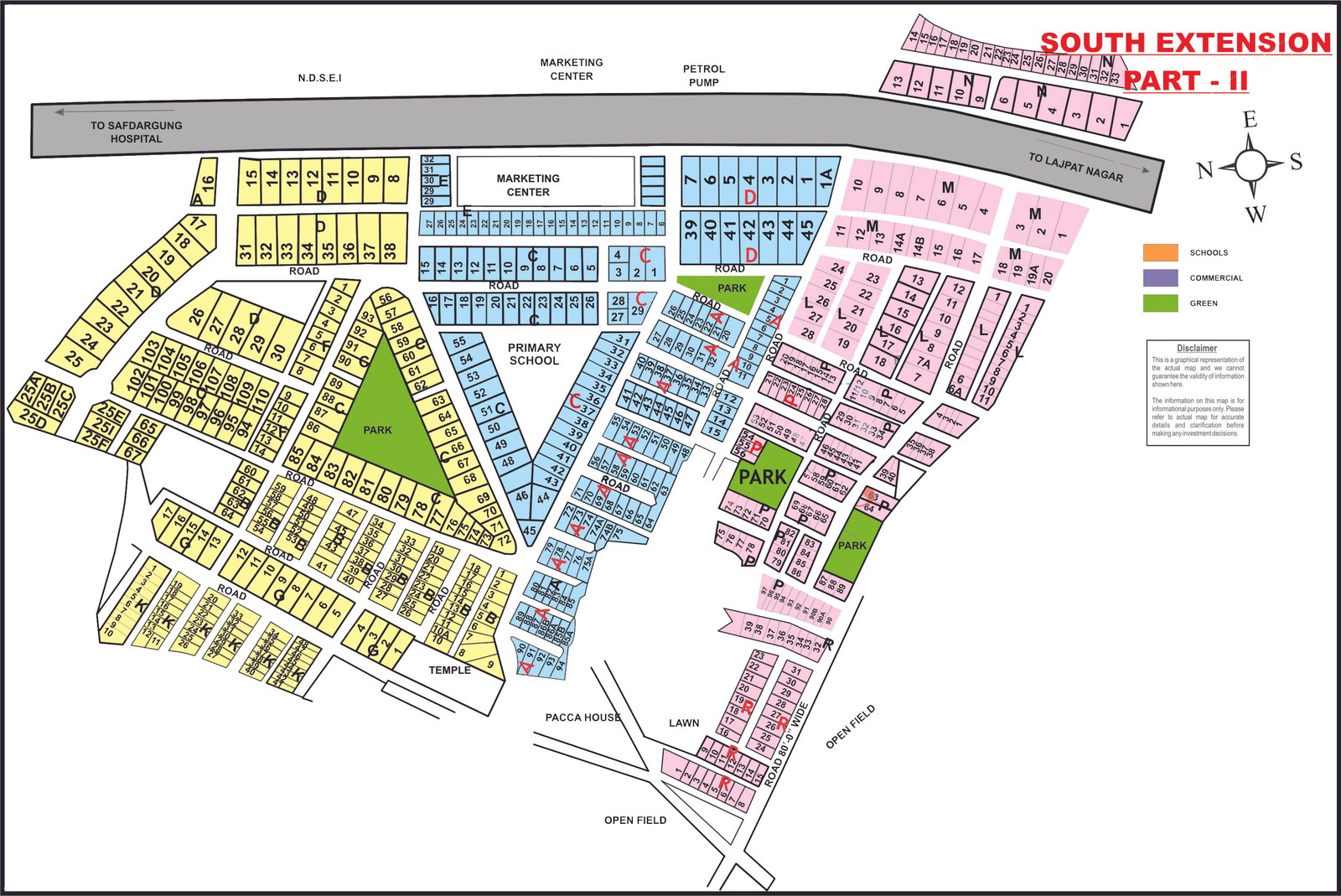
South Extension Part-II
Full size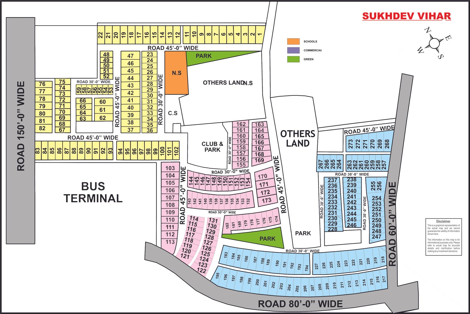
Sukhdev Vihar
Full size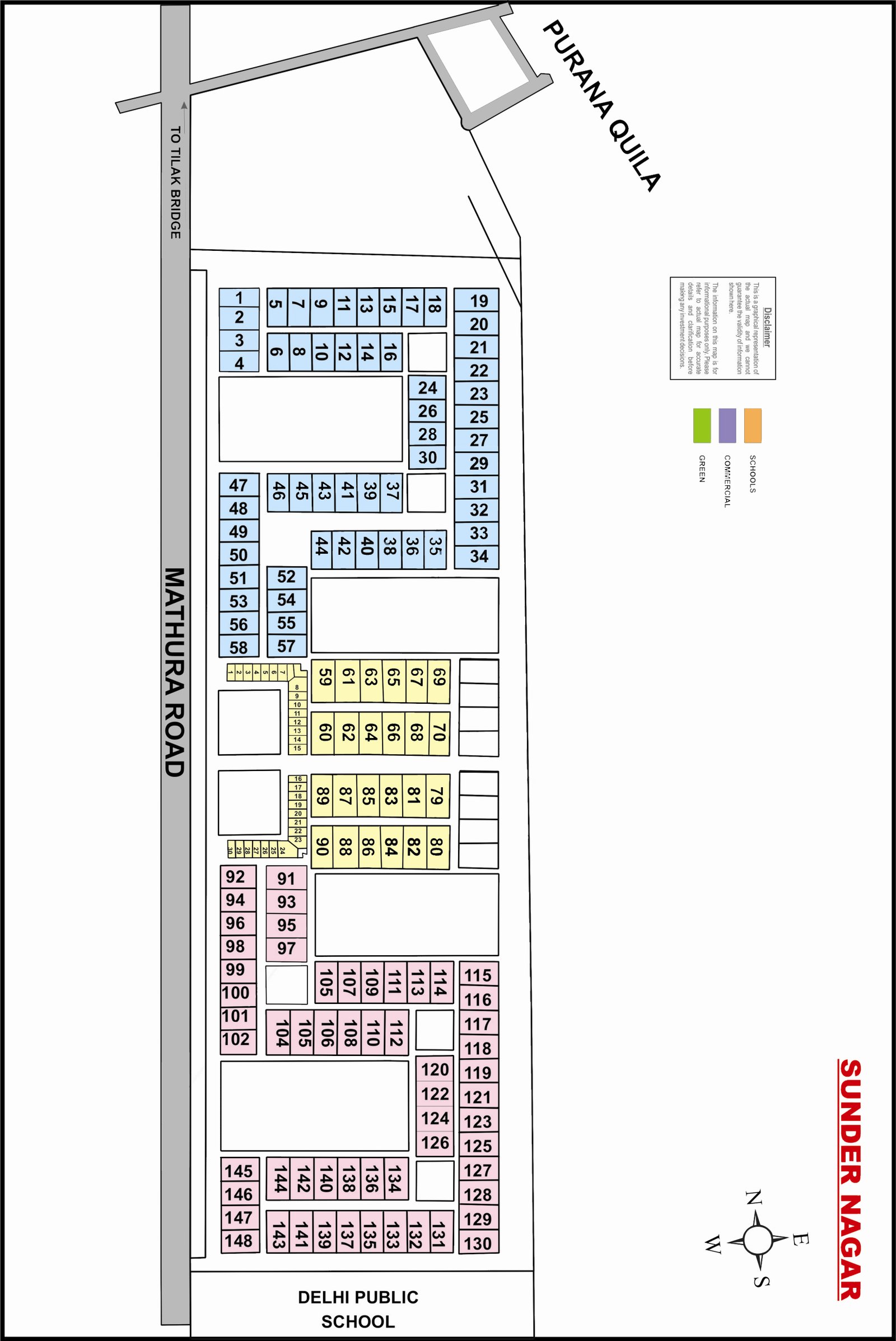
Sunder Nagar
Full size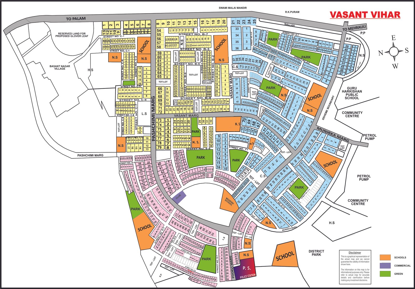
Vasant Vihar
Full size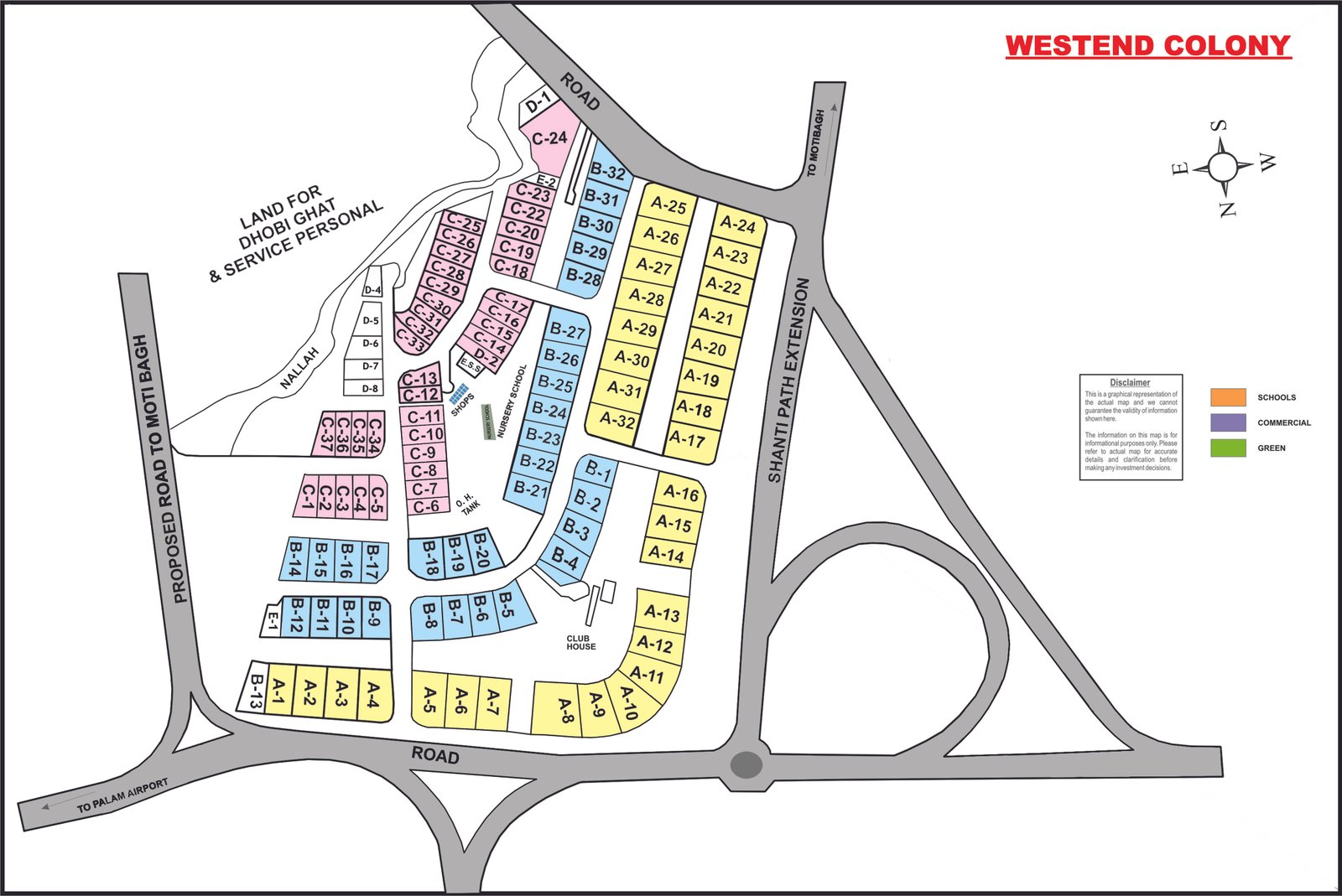
Westend Colony
Full sizeNo map for that colony yet. Ask us.